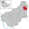
File:Am Ohmberg in EIC.svg
外观

此SVG文件的PNG预览的大小:604 × 599像素。 其他分辨率:242 × 240像素 | 484 × 480像素 | 774 × 768像素 | 1,032 × 1,024像素 | 2,064 × 2,048像素 | 1,149 × 1,140像素。
原始文件 (SVG文件,尺寸为1,149 × 1,140像素,文件大小:510 KB)
文件历史
点击某个日期/时间查看对应时刻的文件。
| 日期/时间 | 缩略图 | 大小 | 用户 | 备注 | |
|---|---|---|---|---|---|
| 当前 | 2023年12月30日 (六) 17:11 |  | 1,149 × 1,140(510 KB) | NordNordWest | upd |
| 2022年12月30日 (五) 20:45 |  | 1,149 × 1,140(578 KB) | NordNordWest | upd | |
| 2019年1月4日 (五) 16:34 |  | 1,149 × 1,140(578 KB) | NordNordWest | upd | |
| 2018年7月6日 (五) 07:06 |  | 1,149 × 1,140(632 KB) | NordNordWest | upd | |
| 2014年1月17日 (五) 18:46 |  | 1,149 × 1,140(655 KB) | NordNordWest | upd | |
| 2011年11月30日 (三) 12:29 |  | 1,149 × 1,140(441 KB) | Hagar66 | 2011-12-01: abolition of collective municipality Eichsfeld-Südharz, creation of "Sonnenstein (Eichsfeld)" | |
| 2010年12月9日 (四) 11:40 |  | 1,149 × 1,140(195 KB) | Hagar66 | {{Information |Description= |Source= |Date= |Author= |Permission= |other_versions= }} | |
| 2010年12月4日 (六) 16:58 |  | 1,149 × 1,140(257 KB) | NordNordWest | {{Information |Description={{de|Lage von Am Ohmberg, Landkreis Eichsfeld, Thüringen, Deutschland}} {{en|Am Ohmberg in District Eichsfeld, [[:en:Thurin |
文件用途
以下页面使用本文件:
全域文件用途
以下其他wiki使用此文件:
- arz.wikipedia.org上的用途
- ceb.wikipedia.org上的用途
- de.wikipedia.org上的用途
- en.wikipedia.org上的用途
- eo.wikipedia.org上的用途
- es.wikipedia.org上的用途
- et.wikipedia.org上的用途
- eu.wikipedia.org上的用途
- fr.wikipedia.org上的用途
- hu.wikipedia.org上的用途
- it.wikipedia.org上的用途
- mk.wikipedia.org上的用途
- nl.wikipedia.org上的用途
- pl.wikipedia.org上的用途
- pt.wikipedia.org上的用途
- sv.wikipedia.org上的用途
- uk.wikipedia.org上的用途
- www.wikidata.org上的用途
- zh-min-nan.wikipedia.org上的用途

