
File:Italy Sardinia relief location map.svg

此SVG文件的PNG预览的大小:334 × 599像素。 其他分辨率:134 × 240像素 | 267 × 480像素 | 428 × 768像素 | 571 × 1,024像素 | 1,142 × 2,048像素 | 601 × 1,078像素。
原始文件 (SVG文件,尺寸为601 × 1,078像素,文件大小:1.62 MB)
摘要
| 描述 |
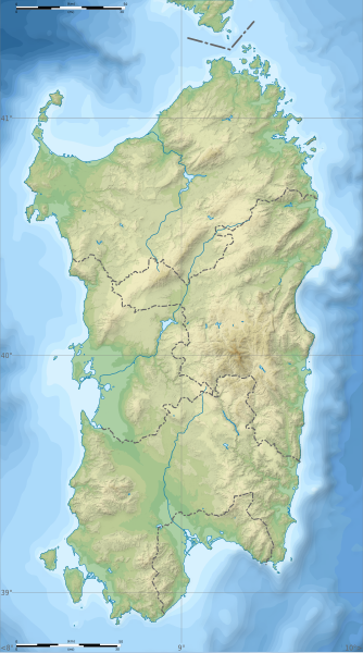
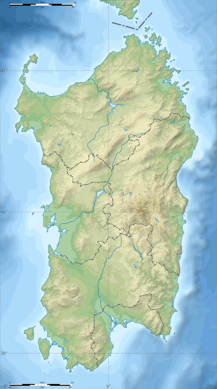
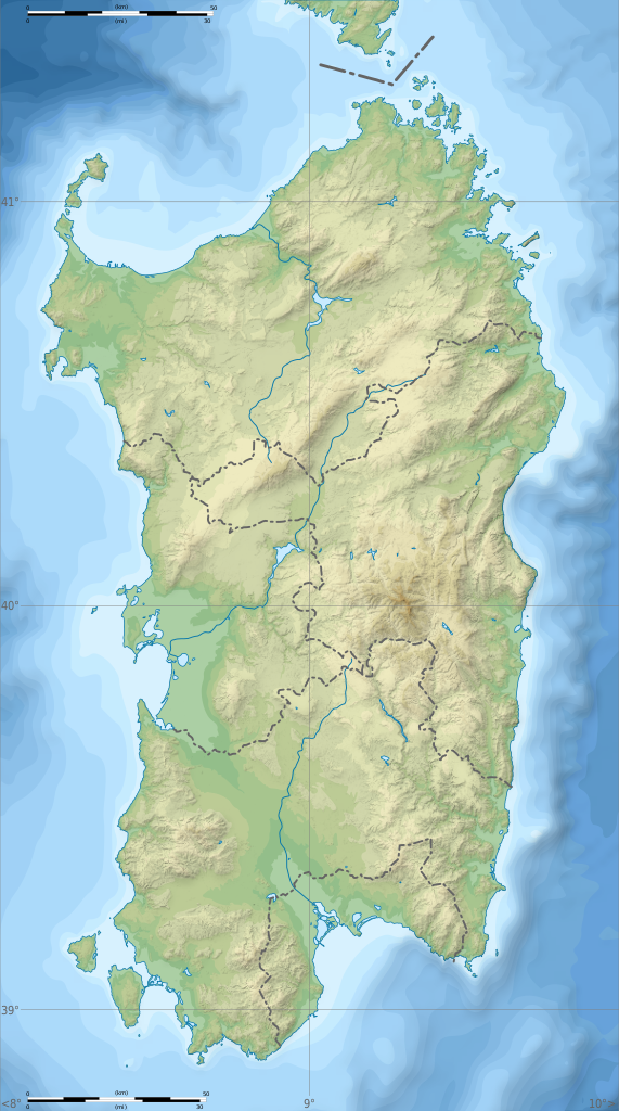
English: Blank physical map of Sardinia, Italy, for geo-location purpose, with province boundaries. Altitude levels : 25m, 50, 100, 200, 400, 600, etc. (same for bathymetry). Français : Carte topographique vierge de la Sardaigne, Italie, destinée à la géolocalisation, avec les limites des provinces. Niveaux d'altitudes : 25 m, 50, 100, 200, 400, 600, etc. Idem pour la bathymétrie.
Geographic limits of the map:
|
| 日期 | (UTC) |
| 来源 |
自己的作品
|
| 作者 | Sémhur |
| 其他版本 |
此文件衍生的作品: Aree protette della Sardegna.svg
|
| 署名 (由许可协议要求) | © Sémhur / Wikimedia Commons / |
| SVG | W3C-validity not checked. |
| Atelier graphique |

| 相机位置 | | 在以下服务上查看本图像和附近其他图像: OpenStreetMap |
|---|
许可协议
我,本作品著作权人,特此采用以下许可协议发表本作品:
| 非营利著作权:本艺术作品是自由的,您可以依据自由艺术作品许可协议的条款传播和/或修改本艺术作品。您可以在Copyleft Attitude网站或其他网站找到该许可协议的样本。 |
This file is licensed under the Creative Commons Attribution-Share Alike Attribution-Share Alike 4.0 International, 3.0 Unported, 2.5 Generic, 2.0 Generic and 1.0 Generic license.
- 您可以自由地:
- 共享 – 复制、发行并传播本作品
- 修改 – 改编作品
- 惟须遵守下列条件:
- 署名 – 您必须对作品进行署名,提供授权条款的链接,并说明是否对原始内容进行了更改。您可以用任何合理的方式来署名,但不得以任何方式表明许可人认可您或您的使用。
- 相同方式共享 – 如果您再混合、转换或者基于本作品进行创作,您必须以与原先许可协议相同或相兼容的许可协议分发您贡献的作品。
您可以选择您需要的许可协议。
文件历史
点击某个日期/时间查看对应时刻的文件。
| 日期/时间 | 缩略图 | 大小 | 用户 | 备注 | |
|---|---|---|---|---|---|
| 当前 | 2018年3月4日 (日) 15:26 | | 601 × 1,078(1.62 MB) | Ruthven | c:User:Rillke/bigChunkedUpload.js: |
| 2018年2月25日 (日) 09:29 |  | 601 × 1,078(1.62 MB) | Ruthven | New province boundaries (2016) | |
| 2010年1月24日 (日) 15:29 |  | 601 × 1,078(1.63 MB) | Sémhur | == {{int:filedesc}} == {{Information |Description= {{en|Blank physical map of Sardinia, Italy, for geo-location purpose, with province boundaries. Altitude levels : 25m, 50, 100, 200, 400, 600, etc. (same for bathymetry)}} {{fr|Carte topo |
文件用途
以下页面使用本文件:
全域文件用途
以下其他wiki使用此文件:
- ar.wikipedia.org上的用途
- az.wikipedia.org上的用途
- ba.wikipedia.org上的用途
- be.wikipedia.org上的用途
- bn.wikipedia.org上的用途
- bs.wikipedia.org上的用途
- ca.wikipedia.org上的用途
- ceb.wikipedia.org上的用途
- ce.wikipedia.org上的用途
- cs.wikipedia.org上的用途
- de.wikipedia.org上的用途
- de.wikivoyage.org上的用途
- dsb.wikipedia.org上的用途
- en.wikipedia.org上的用途
- Lake Gusana
- Punta Sardegna
- Languages of Italy
- Santo Stefano (island)
- San Pietro Island
- Punta La Marmora
- Budelli
- Mechanized Brigade "Sassari"
- Lake Baratz
- 184th Paratroopers Division "Nembo"
- 203rd Coastal Division (Italy)
- 204th Coastal Division (Italy)
- 205th Coastal Division (Italy)
- Lake Coghinas
- Lake Omodeo
- Lake Liscia
- Template:Sardinia regional languages labelled map
- Module:Location map/data/Italy Sardinia/doc
- Gulf of Oristano
- User:Michael!/Project:Location map templates/Italy
- Lake Temo
- Is Molas Challenge
- Is Molas Senior Open
- Module:Location map/data/Italy Sardinia
查看此文件的更多全域用途。