
File:AS17-M-0431.jpg
原始檔案 (1,012 × 1,012 像素,檔案大小:198 KB,MIME 類型:image/jpeg)
摘要
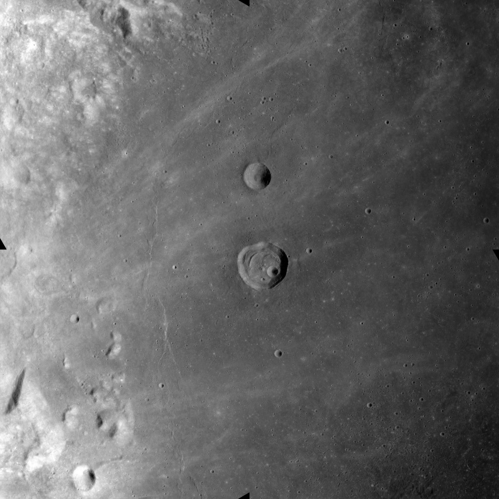
This image was taken during the Apollo 17 mapping metric sequence, revolution #14. The selenographic coordinates of this image are 18.50° N, 53.40° E.
The picture shows the western part of the Mare Crisium, a roughly lunar mare with a diameter of 418 km. The crater at the center of the image is named Peirce, while the smaller crater to the north is Swift. To the west of Perice, and concentric with the edge of the mare, is a wrinkle-ridge named Dorsum Oppel. Wisps of higher albedo material from a ray system can be seen scattered across the otherwise relatively dark surface of the mare.
This picture was produced by reducing a Hi-res image to 25% of full size, then rotating 90° counter-clockwise so that north is toward the top edge.
Source: Lunar & Planetary Institute, http://www.lpi.usra.edu/resources/apollo/frame/?AS17-M-0431 [1]
授權條款
| 本作品由NASA創作,屬於公有領域。根據NASA的版權政策:“NASA的創作除非另有聲明否則不受版權保護。”(參見:Template:PD-USGov/zh,NASA版權政策或JPL圖像使用政策) | ||
 |
警告:
|
檔案歷史
點選日期/時間以檢視該時間的檔案版本。
| 日期/時間 | 縮圖 | 尺寸 | 使用者 | 備註 | |
|---|---|---|---|---|---|
| 目前 | 2018年10月26日 (五) 10:52 | | 1,012 × 1,012(198 KB) | Jstuby | higher resolution, from ASU |
| 2006年1月26日 (四) 19:44 |  | 603 × 600(43 KB) | RJHall | Western Mare Crisium from Apollo 17. |
檔案用途
全域檔案使用狀況
以下其他 wiki 使用了這個檔案:
- ba.wikipedia.org 的使用狀況
- bg.wikipedia.org 的使用狀況
- ca.wikipedia.org 的使用狀況
- cs.wikipedia.org 的使用狀況
- en.wikipedia.org 的使用狀況
- es.wikipedia.org 的使用狀況
- fa.wikipedia.org 的使用狀況
- ru.wikipedia.org 的使用狀況