
File:Lickey incline.jpg
無更高解析度可提供。
Lickey_incline.jpg (640 × 480 像素,檔案大小:59 KB,MIME 類型:image/jpeg)
| 描述 |
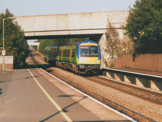
English: Looking up Lickey Incline
The long incline north-east of Bromsgrove station is among the steepest on any main line railway in the UK and was feared by drivers in steam days, but is no hazard for modern diesels. |
| 日期 | |
| 來源 | From geograph.org.uk |
| 作者 | Stephen Craven |
| 授權許可 (重用此檔案) |
Creative Commons Attribution Share-alike license 2.0 |
| 姓名標示 (由许可协议要求) | Stephen Craven / Looking up Lickey Incline / |
| 拍攝地點 | | 位於此地的本圖片與其他圖片: OpenStreetMap |
|---|

|
此圖像來自Geograph工程圖集。攝影師的聯繫資訊請見Geograph網站上該照片的頁面。此圖像的著作權人為Stephen Craven,採用創用CC 署名-相同方式共享 2.0許可協議授權二次使用。
|
此檔案採用創用CC 姓名標示-相同方式分享 2.0 通用版授權條款。
姓名標示: Stephen Craven
- 您可以自由:
- 分享 – 複製、發佈和傳播本作品
- 重新修改 – 創作演繹作品
- 惟需遵照下列條件:
- 姓名標示 – 您必須指名出正確的製作者,和提供授權條款的連結,以及表示是否有對內容上做出變更。您可以用任何合理的方式來行動,但不得以任何方式表明授權條款是對您許可或是由您所使用。
- 相同方式分享 – 如果您利用本素材進行再混合、轉換或創作,您必須基於如同原先的相同或兼容的條款,來分布您的貢獻成品。
原始上傳日誌
The original description page was here. All following user names refer to en.wikipedia.
- 2007-03-10 15:18 T.roome 640×480× (60303 bytes) Author Steven Craven found on www.geograph.org.uk link to photo. https://www.geograph.org.uk/photo/222761
檔案歷史
點選日期/時間以檢視該時間的檔案版本。
| 日期/時間 | 縮圖 | 尺寸 | 使用者 | 備註 | |
|---|---|---|---|---|---|
| 目前 | 2008年10月20日 (一) 14:26 | | 640 × 480(59 KB) | Angusmclellan | {{Information |Description={{en|Looking up Lickey Incline The long incline north-east of Bromsgrove station is among the steepest on any main line railway in the UK and was feared by drivers in steam days, but is no hazard for modern diesels. }} |Source=F |
檔案用途
下列頁面有用到此檔案:
全域檔案使用狀況
以下其他 wiki 使用了這個檔案:
- arz.wikipedia.org 的使用狀況
- azb.wikipedia.org 的使用狀況
- en.wikipedia.org 的使用狀況
- en.wikivoyage.org 的使用狀況
- nl.wikipedia.org 的使用狀況
- simple.wikipedia.org 的使用狀況
- www.wikidata.org 的使用狀況