
File:Subang Jaya.jpg

預覽大小:800 × 600 像素。 其他解析度:320 × 240 像素 | 640 × 480 像素 | 1,024 × 768 像素 | 1,280 × 960 像素 | 2,560 × 1,919 像素 | 4,000 × 2,999 像素。
原始檔案 (4,000 × 2,999 像素,檔案大小:7.61 MB,MIME 類型:image/jpeg)
| 描述 |
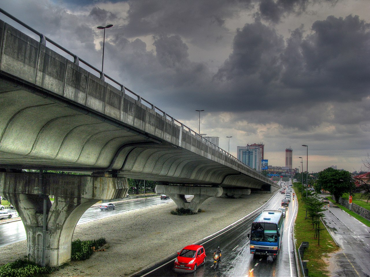
Subang Jaya was the location for BarCampKL 2010. It is also probably one of the least pedestrian-friendly places on Earth. In fact, I suspect that the planners of Subang Jaya did not really believe in the existence of pedestrians, regarding them as mythical creatures like elves and pixies. Refusing to allow their plans to be sullied by such superstitious nonsense, they were careful to ensure that Subang Jaya is entirely free of the blemishes of sidewalks and pedestrian crossings. They almost succeeded, but not quite. Subang Jaya has a smattering of pedestrian footbridges. This picture was taken from one of them. This image was created by tone-mapping an HDR image generated from three separate exposures. The HDR image was generated and tone-mapped using Photomatix Pro. |
||
| 日期 | |||
| 來源 | Flickr: Subang Jaya | ||
| 作者 | Robert Lowe | ||
| 授權許可 (重用此檔案) |
此檔案採用創用CC 姓名標示 2.0 通用版授權條款。
|
| 拍攝地點 | | 位於此地的本圖片與其他圖片: OpenStreetMap |
|---|
檔案歷史
點選日期/時間以檢視該時間的檔案版本。
| 日期/時間 | 縮圖 | 尺寸 | 用戶 | 備註 | |
|---|---|---|---|---|---|
| 目前 | 2013年10月10日 (四) 16:18 | | 4,000 × 2,999(7.61 MB) | Flickr upload bot | Uploaded from http://flickr.com/photo/8143486@N04/4599202529 using Flickr upload bot |
檔案用途
下列頁面有用到此檔案:
全域檔案使用狀況
以下其他 wiki 使用了這個檔案:
- en.wikipedia.org 的使用狀況
- ta.wikipedia.org 的使用狀況