
File:Numbered map of Adjuntas wards.png
此為最大尺寸。
Numbered_map_of_Adjuntas_wards.png (545 × 484 像素,檔案大小:8 KB,MIME 類型:image/png)
| 描述 |
|
||
| 日期 | |||
| 來源 | own work (based on http://areciboweb.50megs.com) | ||
| 作者 | Alessandro Cai (OliverZena) | ||
| 授權許可 (重用此檔案) |
|
檔案歷史
點選日期/時間以檢視該時間的檔案版本。
| 日期/時間 | 縮圖 | 尺寸 | 使用者 | 備註 | |
|---|---|---|---|---|---|
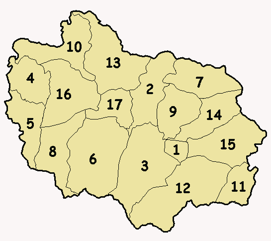
| 目前 | 2007年3月14日 (三) 17:32 | | 545 × 484(8 KB) | OliverZena | {{Information| |Description=*{{en}} Numbered '''wards map''' (alphabetical order) of the municipality-island of '''Adjuntas''', Puerto Rico. *{{es}} Mapa numerado (orden alfabético) de los barrios del municipio de '''Adjuntas''', Puerto Rico. *{{ |
檔案用途
下列頁面有用到此檔案:
全域檔案使用狀況
以下其他 wiki 使用了這個檔案:
- it.wikipedia.org 的使用狀況